


Garmin - BlueChart G3 Upgrade SDCard - North Island
Description
Description

Details
Experience unparalleled coverage and brilliant detail when you’re on the water with charts that feature integrated Navionics® data, Auto Guidance technology¹ and more.
- Provides exceptional coverage, clarity and detail with coastal charts that feature integrated Garmin and Navionics® data
- Auto Guidance¹ technology calculates a route using your desired depth and overhead clearance and provides a suggested path to follow
- Includes depth range shading for up to 10 depth ranges, enabling you to view your target depth at a glance
- Up to 1’ contours provide a more accurate depiction of the bottom structure for improved fishing charts and navigation in swamps, canals and marinas
- Includes the entire coast of the North Island, including the Three Kings Islands; also includes the northernmost part of the South Island, from Cape Foulwind to Cape Campbell, including Nelson.
Auto Guidance Technology
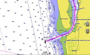
Whether you are fishing or cruising, select a spot, and get a route showing you the general path and nearby obstructions at a safe depth1.
Depth Range Shading
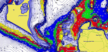
This feature displays high-resolution depth range shading for up to 10 depth ranges so you can view your designated target depth.
Detailed Contours
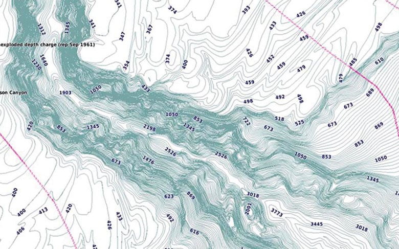
BlueChart g3 charts feature 1’ contours that provide a more accurate depiction of bottom structure for improved fishing charts and enhanced detail in swamps, canals and port plans.
Shallow Water Shading
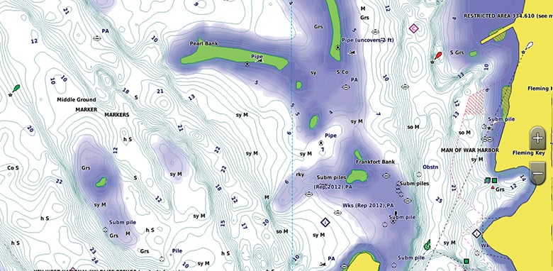
To aid in navigation, Shallow Water Shading allows map shading at a user-defined depth to give a clear picture of shallow waters.
Delivery and Shipping (Parts & Accessories - Online Store)
Delivery and Shipping (Parts & Accessories - Online Store)
Orders are fulfilled same day unless after 3pm, in that case orders are fulfilled first thing the following morning.
All shipping labels are Overnight Delivery however this is not guaranteed, especially to South Island. (subject to local shipping delays)
If SATURDAY DELIVERY is selected, cut-off is Friday 1:30pm - NORTH ISLAND and Thursday 1:30pm - SOUTH ISLAND - SATURDAY DELIVERY is not applicable to rural addresses, please choose a non-rural address.
Garmin - BlueChart G3 Upgrade SDCard - North Island is **BACKORDERED** and will ship as soon as it is back in stock. Call or message for ETA

Garmin - BlueChart G3 Upgrade SDCard - North Island
